challenges students and astronomers to find ancient Bounds
"This really is law. Every aspect of it. Surveying, title work, historical research." Mike Farber
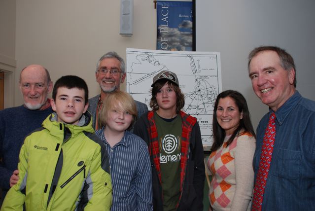
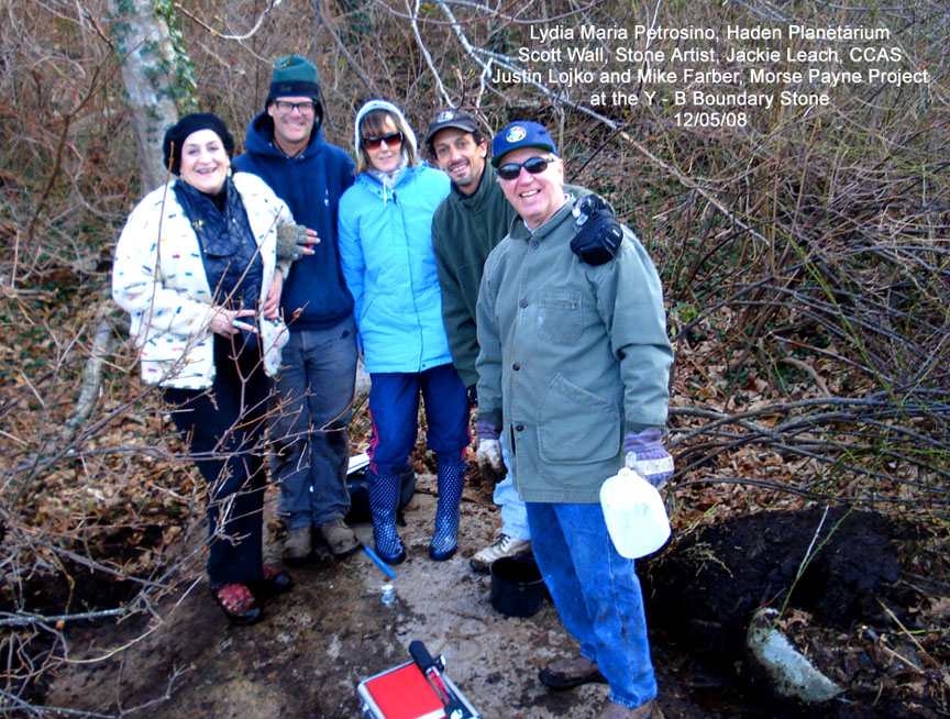
At the December 4, 2009 Cape Cod Astronomical Society meeting Guest speaker Mike Farber presented an overview of the Cornerstone Project in which through the auspices of the Cape Cod Lighthouse Charter School (CCLCS) he is documenting the surveying techniques used by early settlers of Cape Cod to establish town and property boundaries. He highlighted the original work done by Morris Paine tracking the settlers’ creation of a natural compass rose site in Cape Cod Bay with reference points on Race Point in Provincetown and Yarmouth. Mr. Farber is seeking additional team members from the CCAS community to locate boundary historic markers that the settlers established in the 1640 timeframe and thereafter.
This is not the first collaboration between CCAS and the CCLHCS. In 1999, then eighth grade science teacher Paul Niles was awarded a national grant, the Toyota Grant, which enabled the school to bring astronomer John Dobson to the school,as well as provide other essential ingredients of a telescope making program. During the 2001-'02 school year, astronomers from the club gave several presentations to students on topics ranging from sunspots to a virtual tour of the cosmos. Club members also donated optical equipment to the Charter Lighthouse School.
Based on the theories of Morse Payne, Michael Farber and the students at Cape Cod Lighthouse Charter School are attempting to explain this ancient bound system which originated at the headwaters of Bound Brook ~ the landing point for the first magnetic north line drawn in the New World.
A group of Cape Cod Lighthouse Charter School history students and a Chatham historian are hot on the trail of William Bradford's first perambulation of Cape Cod and now CCAS members are being asked to participate.
The students and their outside adviser, Michael Farber, believe the Plimoth Colony governor's 50-mile walk in 1622 from Orleans to Plymouth along Cape Cod Bay may put a face and a name to their premise about how the early settlers set the boundaries for the first Cape Cod towns. Known as The Cornerstone Project, it works off a theory developed in 1985 by retired architect and historian H. Morse Payne.
While the historians have noted Bradford's walk across Cape Cod — around Thanksgiving time of that year — Farber and the students have yet to find descriptions of what he did on that trip. But, they are excited about what it could mean to the project, Farber said.
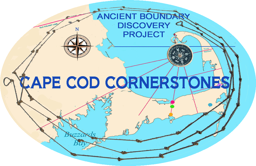
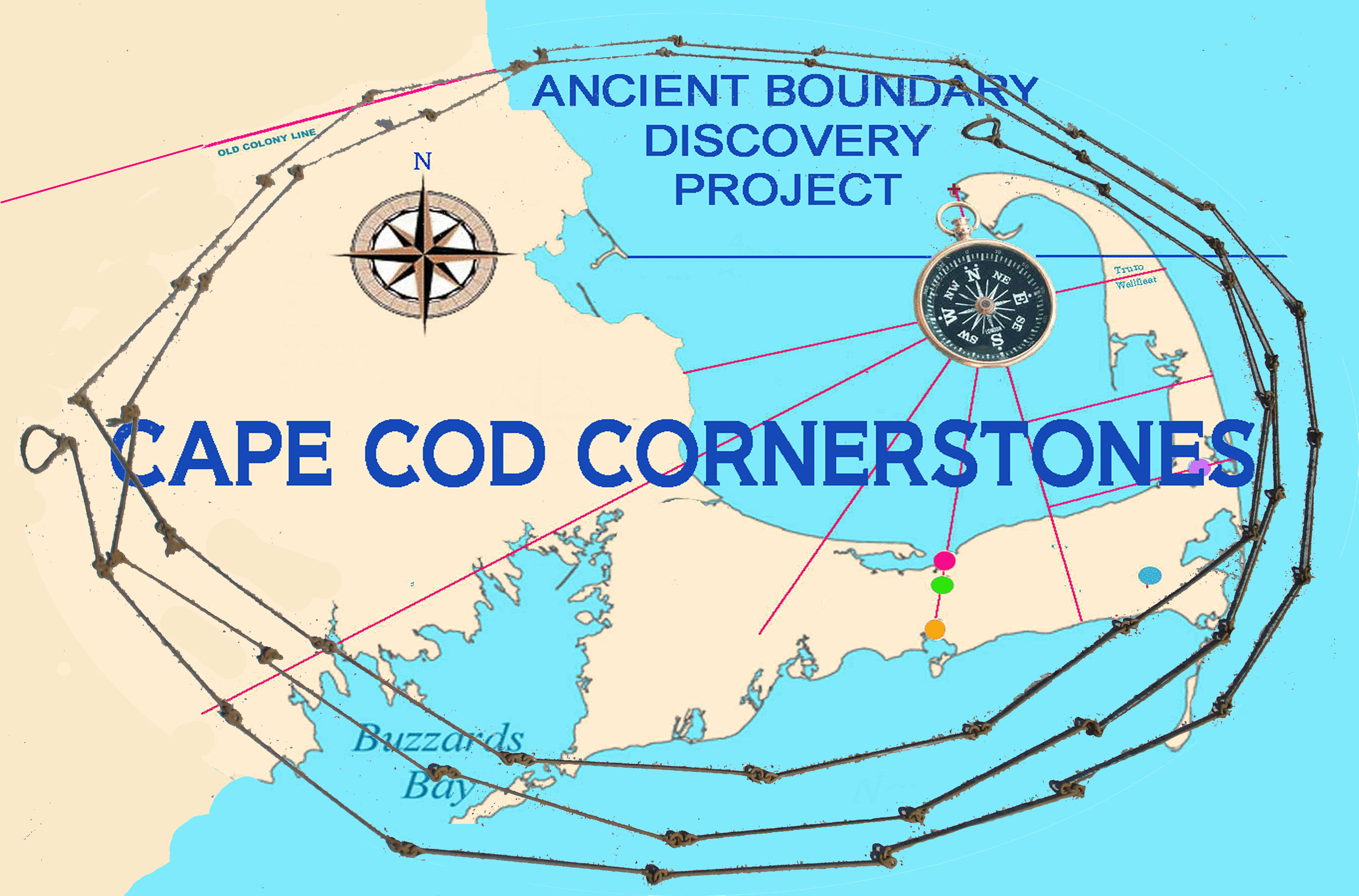
The Cornerstone Project starts with Payne's discovery that the English Pilgrims arriving in the New World in 1620 had found a surprise when they first sailed around the tip of Provincetown and into Cape Cod Bay. By the time they had navigated into the bay, the needle on their compass had spun all the way around, and they realized it represented Cape Cod as a circle.
The settlers would later use this to divide the region according to the English pie-shaped surveying methods, Payne said.
Around 1630, the Pilgrims used the configuration to set the original cornerstones for the first four towns, Sandwich, Barnstable, Yarmouth and Nauset, Payne surmised.
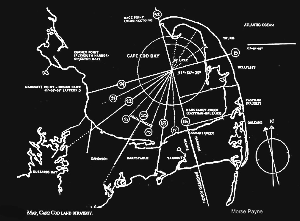
To survey the towns, the Pilgrims would have established a central point in the bay, using an east-west line from Wellfleet to Manomet in Plymouth, and a north-south line set along the magnetic north — which results from molten iron in the earth's core and orients all compasses to the north — from Race Point in Provincetown to Quivet Creek in Dennis, he said.
And this is where Bradford comes in, Farber believes.
Early records place him on Cape Cod in late November of 1622, after having secured the colony's winter supply of corn and beans from the Nauset Indians in the area now known as Orleans, said Farber. Bradford's ship then returned to Plymouth, but he decided to walk back. Farber believes it may have been on this journey that Bradford, a scholarly man well-trained in astronomy, geography, navigation and land surveying, set the first surveying mark ever established on Cape Cod, at a body of water called Bound Brook, today known as Quivet Creek.
Using accounts in historic documents, Farber, Lighthouse history teacher Daniella Garran, and a group of 11 sixth, seventh and eighth graders have pieced together an account of Bradford's walk during which he may have set the surveying mark on a tree at Bound Brook.
Historical documents corroborate that Bradford walked back with a small band of settlers.Since there was only one Indian footpath that traversed the bay marshes to the north at Quivet Creek and the ponds to the south, Farber believes Bradford most certainly used this path to travel back to the colony.
A Plymouth Court Record of 1641 confirms that there was a marker tree later used in surveying boundaries. It describes the boundaries of the town of Yarmouth, which originally included the town of Dennis.
"The bounds of Yarmouth on the easterly side are from the town to a certain brook by the Indians called Shuckquam, but by the English Bound brook," the record reads. "And from a marked tree at the path on the said Bound brook by a straight line south by east to the south sea."
The question is whether Bradford was the one who named the creek Bound Brook and set the mark, Farber said. He believes so.
"There is a branch of history called imaginative conjecture," he said. "Bradford was a very bright, classical scholar who could speak six languages. We show disrespect for this Renaissance man in not seeing him walking the flats or the path at Bound Brook with a compass in hand and magnetic north in his mind. That guy was thinking on higher terms."
Payne, 86, of Bedford, said he believes Bradford was the man who etched the tree at Quivet Creek. It's logical to think Bradford, who was the political leader of the colony, would have been walking back to Plymouth precisely to get a lay of the land, he said. Since the Pilgrims used natural markers like trees and boulders to establish boundaries, Bradford most certainly would have done the same, Payne said.
Garran, who is leading the second seminar at the Orleans charter school on The Cornerstone Project, said she and the students are "guardedly optimistic" that the theory is true.
"I think it's because we've trained them to ask questions," she said of the students. "I think we've produced some pretty good little historians that thrive on uncertainty. They want to find the primary resources that reference this and prove it."
The Pilgrims were meticulous record keepers, and Bradford himself kept a journal throughout his 36 years as governor of Plimoth Colony, Garran said. When the students reconvene for another Cornerstone seminar in the spring, they will continue their research, she said.
here."
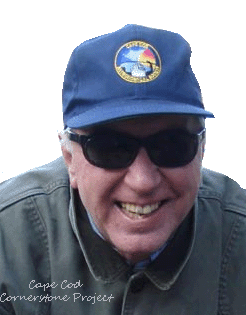
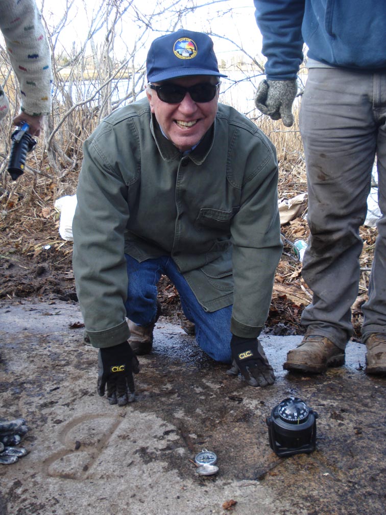
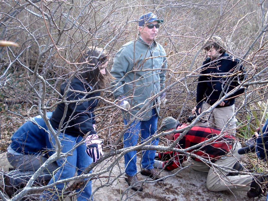
Mike Farber takes a knee on Payne Rock. Photo Tom Leach
The Cornerstones of Cape Cod are being rediscovered after 375 years!
By the 1630s, the Pilgrim Elders knew that Cape Cod was their New Promised Land. Boxed in by Massachusetts Bay Colony to the north and barren ground to the south and west, they could only head eastward. They came to Bound Brook at Quivet Creek to establish the Cape's first land survey in the New World.
Yet another boundary uncovered. This recently rediscovered stone at Hallet's Mill Pond in Cummiquid with Y + B etching may hold more authenticity than Plymouth Rock
The sub-division of land was based on 32 points of a circular magnetic compass (a form of measurement used by mariners with each point equaling 11 and 1/4 degrees, and with each point represented by a line radiating out from the meetinghouse
at the center.
The system of surveying land was well established in England. The following
dates are related to significant dates in surveying history:
1555—Surveying
triangulation was established.
1581—Magnetic compass needle utilized
in surveying.
1606—Galileo invented the proportional
compass.
1608—Dutch scientist invents the telescope.
1625—“Surveyors Manual” published .
Practically every man in the colony was capable of working
with a compass and served on road surveying teams and fence viewing duty.
The magnetic compass was the principal device used for land surveying. While at sea the true north alignment was observed in the night sky utilizing the polar star. There is a difference (variation) between magnetic north and true north of approximately 10o over a 200 year period. The magnetic polar region is located in northern Canada, above Hudson Bay in the islands area about 1,000 miles southwest of the North Pole.
Diagram of how Morse Payne theorized the Pilgrims used the English pie-shaped system to layout the forearm towns and the Roman System use for the elbow to the wrist of Cape Cod.
Morse Payne had first observed this circular pie-shaped form as a system employed for the sub-division of land on Cape Cod. The Plymouth Colony utilized this method in 1639 when the first three towns were established for Sandwich, Barnstable and Yarmouth, some 9 years after the Cambridge land division system occurred (See: Cape Cod Genealogical Society Bulletin, “Cape Cod Land Strategy”, December 1994, p. 183. H. Morse Payne).
The Cape Cod system utilized two points (not three) with a center point in the middle of Cape Cod Bay, and each two point division was exactly the same angle as the abutting town. This was discovered in 1980 and has been well received and accepted as a contribution to Cape Cod history, but this made Payne wonder if such a circular form existed elsewhere?
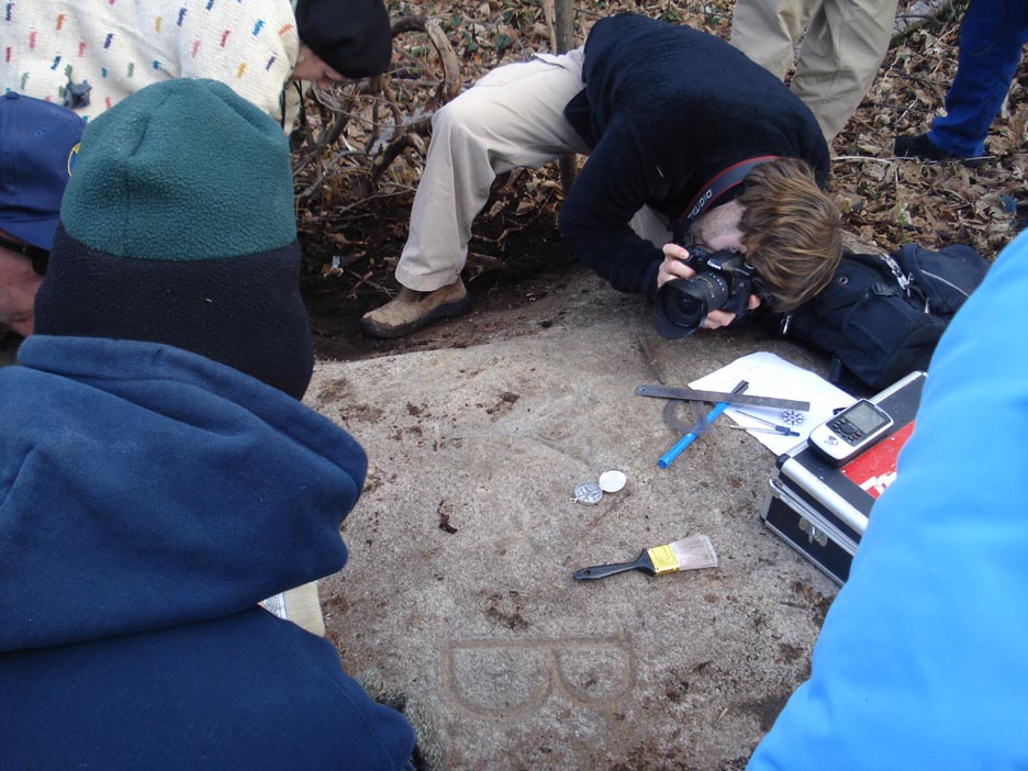
Farber and the eighth graders found a boulder in Town Cove marked by an 18-inch “X” which he believes is a marker stone in a cluster of rocks denoting the southernmost boundary of the town of Eastham. Students found the rock after seeing it in a photograph taken 100 years ago by H.K. Cummings, part of a collection housed at the Snow Library in Orleans.
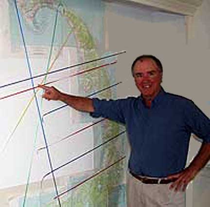
The boulder is an important piece of the puzzle that Farber is trying to assemble to prove a theory developed by architect H. Morse Payne in the 1980s. Payne, who designed Nauset High School, suggested that the original Cape town boundaries radiate from a center point in Cape Cod Bay, “a natural compass rose,” said Farber, and that the Pilgrim Elders located the point along a line stretching from Provincetown to Quivet Creek in Dennis both of which would have been visible from the mast of a ship stationed in the center of the Bay following magnetic north.
On a wall in his Chatham apartment, Michael Farber has recreated Morse Payne’s maps showing how boundary lines of Cape towns radiate from a center point in Cape Cod Bay. TIM WOOD PHOTO
According to Farber, boundaries of Sandwich, Barnstable and Yarmouth established in 1639 all converge on this center point. He’s tentatively located a similar boundary that stretches from Quivet Creek to Nantucket Sound in Harwich, and believes that the cluster of stones found in Town Cove also point to the same spot in Cape Cod Bay.
Finding that exact spot is proving to be a bit tricky, and locating the actual stone or stones that Farber believes was placed at the location by the Pilgrim surveyors almost 400 years ago may be impossible.
Sands could have covered the rocks, and fishing draggers which work the bay “could have run over that rock, could have moved it,” he said. That’s why the project is initially focusing on what’s visible, the clusters of rocks Farber has seen while sailing along the Cape Cod Bay shore that he thinks may be some of the ancient cornerstones.
A growing group of researchers is helping Farber in his “Cornerstone Challenge” which includes author William Martin, Clark University Professor Paul Burke, and Paul Niles science teacher at the Lighthouse School. Payne, a Bedford resident now in his 80s, also advises Farber.
Farber, whose brother Peter is a well-known Chatham lawyer and whose nephew Dawson is the Orleans Harbormaster, moved here from West Virginia to oversee the renovation of his family’s home in Brewster. Now he’s consumed by the Cornerstone Project; maps, papers and books have taken over his apartment, and he spends most of his time researching or doing field work, a lot of which consists of sailing the shore identifying the rock clusters shown on some maps of the Cape. The work calls on many of the skills he developed as an attorney, he said.
“This really is law,” he said, “every aspect of it. Surveying, title work, historical research.”
The topic first drew his attention when he “stumbled” upon a 1985 article by Payne outlining the cornerstone theory.
“It just leaped out at me that this man was on to something,” Farber said. He contacted Payne, who was eager to share his research.
“He had done all the theory work but none of the field work,” Farber said. “I decided to do the field work, and it quickly grew into an archeological project.”
One curiosity is that while the boundaries between many upper and mid Cape towns appear to radiate from the center point in the bay, the divisions between most lower Cape towns are at a 90-degree angle from that magnetic north line. The town of Eastham, for instances, appears to have been divided into seven lots, one for each of the original settling families, with the bounds coming off the magnetic north line at a 90-degree angle.
This shows how the Pilgrims used a sophisticated blend of surveying techniques, Farber said. The grid-type system used to divide up Eastham was Roman in origin, while subdividing land based on a pie-shaped circle was English, and was used, according to papers by Payne, to lay out early Massachusetts Bay Colony towns.
Recently, archeologist Catherine Macort signed on to the project, and Farber plans to continue to work with Lighthouse School students, who are lead investigators of the Town Cove site. He’s also issued a challenge to Cape Cod surveyors to participate.
“It’s an educational initiative,” Farber said in describing the project. “To include the whole Cape community in the project is the objective.”
Farber recently filed an amended special use permit application with the state board of underwater archaeological resources to continue work on the Town Cove cluster. Along with students and other volunteers, he plans to further investigate the “X” boulder and determine if the mark is man-made or natural, as well as conduct off-shore searches to find more boulder clusters. He’s also working with property owners in Truro to investigate the origins of a cluster of boulders just offshore which he believes may be another key in the cornerstone puzzle.
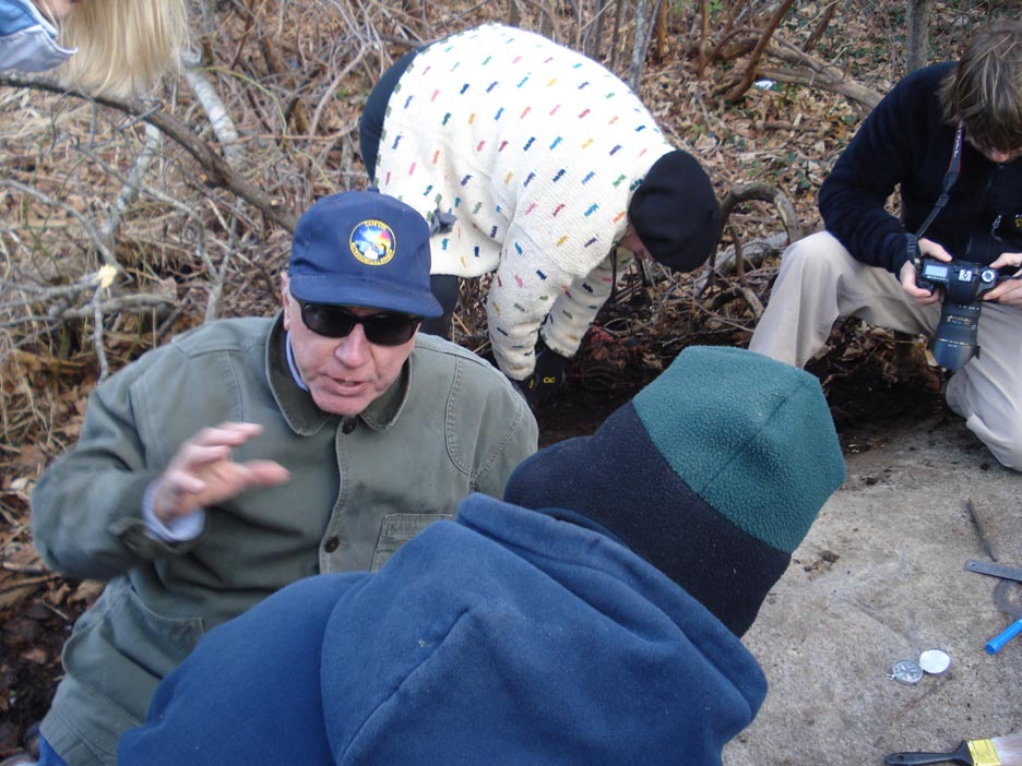
Mike Farber standing on "Payne Rock".
Mike Farber standing on "Payne Rock".
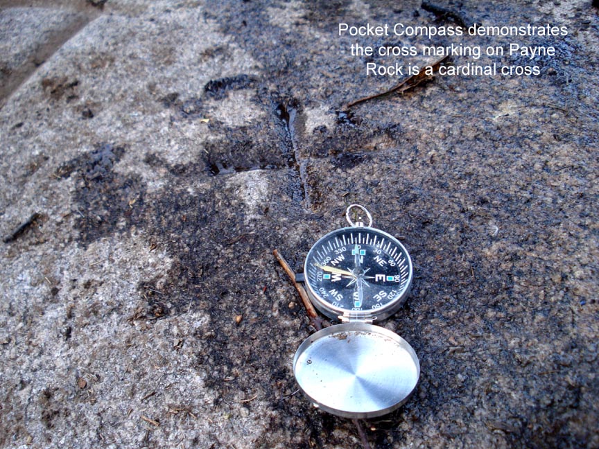
The Cardinal Cross on "Payne Rock".
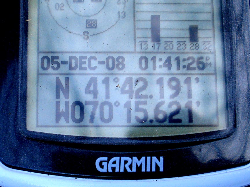
GPS reading at "Payne Rock".
.
.
.
.
Sources:
Cape Cod Times, Robbin Lord, 2008
Cape Cod Chronicle, Tim Wood, 2008
"The Ordering of Towns", H. Morse Payne, New England Antiquities Research Association 2000
"The Suvey of the Old Colony", H. Mores Payne, 1985
CUMMAQUID — (12/08/08 CCT) Michael Watson knew his family's restaurant property straddled the Yarmouth-Barnstable town line. But he had no idea it might be playing host to an ancient Cape Cod landmark.
Last week, members of a group investigating how the Pilgrims established the boundaries of the first Cape Cod towns found a large, flat granite boulder nestled in the marsh mud behind Anthony's Cummaquid Inn.
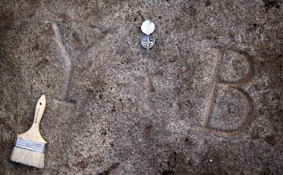
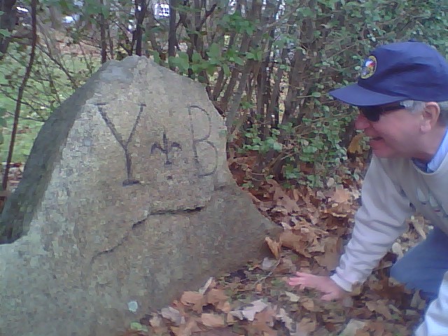
Engraved on the top of the rock are the letters Y and B, with a small x in the middle.
Chatham historian Michael Farber and Cape Cod Lighthouse Charter School teacher Daniella Garran believe the boulder may have been etched by Pilgrims in the early 17th century to mark the Yarmouth-Barnstable boundary line.
If so, the rock would be another important piece in the Cornerstone Project puzzle.
Project members are working off a theory put forth by H. Morse Payne, a retired architect and historian, and a descendant of the first Yarmouth settlers. In 1985, he wrote about the Pilgrims' discovery that Cape Cod's geographical configuration represented a complete round compass. Payne postulated that they divided the Cape's "compass" by establishing a north-south line from Quivett Creek in Dennis to Wood End in Provincetown, bisected by an east-west line from the Truro-Wellfleet line to Manomet Point in Plymouth.
Working from the center point in Cape Cod Bay, where the lines crossed, Payne believes the Pilgrims radiated the boundary lines out to establish the boundaries of the first four towns: Sandwich, Barnstable, Yarmouth and Nauset.
Farber said he believes the Cummaquid rock may date back to 1641, when Pilgrims Edward Winslow, Miles Standish and Edmund Freeman were sent to Yarmouth by Gov. William Bradford to settle the bounds of Yarmouth and Barnstable.
Farber knew that Yarmouth town legend told of an ancient boundary marker beside Mill Pond in Cummaquid. Last week, he and his assistant, Justin Lojko, received permission from Watson to explore the property. Lojko, who was walking along the edge of the pond, had almost given up, when he realized he was standing on a large flat rock. When he scratched away the half-inch or so of mud, he saw what looked to be some engravings, he said. The graceful letters were revealed fully when he and Farber removed the mud and flushed the surface with pond water.
"You have a treasure trove here," Farber told Watson on Friday, as he led a group of about a dozen people down an embankment to the marsh behind the restaurant. Walking to the marker rock, it was evident why it had remained hidden for so many years. Uneven terrain, slippery rocks and clusters of brambles and marsh grass surround it.
Lighthouse Charter School student Joey Benedict voiced the general reaction when the group peered through the reeds at the engraved rock.
"Wow," he whispered, as he moved forward for a closer look.
The eighth-grader has been part of the Cornerstone Project since last spring, when Garran and fellow teacher Paul Niles led a seminar at the school. The seminar continued this fall, and will start up again next spring.
The Cummaquid rock is the second etched boulder the students have found with Farber's assistance. Last spring, they located a huge boulder in Town Cove in Orleans that has a large X dug into it. They believe it is a boundary marker for the Orleans-Eastham line.
Some of the early settlers were trained surveyors, Farber said. They used an English form of surveying, which sets boundaries by radiating out from a center point in a pie-slice configuration. They always worked off magnetic north, which is determined by molten iron in the Earth and orients all compasses.
Farber said he believes the Cummaquid rock lies along the line radiating out from the center point in the bay and crosses the north side at Anthony's Cummaquid Inn and the south side at Hyannis Harbor.
The boundary rock in Hyannis Harbor already has been found, Farber said. The line connecting the two rocks across Cape Cod "may be the first coordinate in the whole New World," he said.
Expert stone carver Scott Wall of Harwich on Friday said the letters on the Cummaquid rock were beautifully crafted.
"They were done by a skilled carver," he said, as he delicately brushed away dirt and sand from the indentations in the gray granite. It is likely early surveyors would have brought a stone carver with them, he said. "They took a lot of trouble to make this set of letters."
Mike Farber examines another Y - B border stone on the roadside at Rte 6A and ponders meaning of a Fleur-De-Lyse.
A Border Stone on Route 6A may be part of the Pilgrim survey
More research is needed to confirm the history of a second stone
CUMMIQUID - (12/10/08) Due to recent newspaper plublicity which has highlight the re-discovery of the Cornerstone Boundaries, historian Mike Farber was contacted about the significance of a border stone that sits in a hedge along Route 6A at what more obvious a place as right next the State "Entering Barnstable" sign. Weekly thousands of motorists have driven past this granite marker that has quietly done its job marking the Town line for more than three centuries. According to Farber everything appears in line on this one with the "Payne Rock" found last week at the Anthony's Cummiquid Inn property. This stone has the familiar carved "Y - B" about 8" high with the Y and B separated by a Fleur-De-Lyse. The signicance of the french symbol has yet to be determined but may be an arrow in this case pointing South. As more
clues are uncovered, more questions are being asked about how our fore Fathers accomplished this county-wide survey. (41° 42.066'N, 070° 15.622'W)
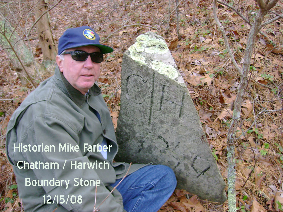
Known stone between Chatham and Harwich appears to be dated 1744.
Later Chatham Harwich Bound located
CHATHAM - (12/15/08) Mike and Justin find another bound, this one is definitely post Bradford with a C/H and what appears a date 1744. Chatham became a Town in 1712. It's off Morton Road, where it intersects with the bike trail. You walk west
on the bike trail about a 1/4 of a mile and then head to the northwest under
the power line to the other side. It's back in the woods there along a foot
path. As Mike Farber says "It would be hard to find without Justin Lojko guiding you." Olde Harwich, also known as "Reserve Territory" in William Bradfords time, was land being held for the native Americans, which encompassed what is Harwich, Chatham, Brewster and South Orleans today. Harwich was first broken up to create Chatham, and later Brewster. So later bounds were added such as this one to delineate this.
All Granite Bounds are important but not all are part of the Cornerstone
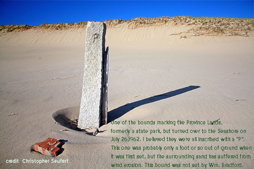
PROVINCETOWN - (12/15/08) Of course, not every bound on Cape Cod goes back to the 17th Century. This looks to me to be one of the bounds marking the Province Lands,
formerly a state park, but turned over to the Seashore on July 26,1962. I
believed they were all inscribed with a "P". This one was probably only a
foot or so out of ground when it was first set, but the surrounding sand has
suffered from wind erosion. N.B. This bound was not set by Wm. Bradford.
(Chet Lay, Slade Associates) The boundary between Truro and Provincetown changed in 1813, so not sure if that affects the discussion. In 1893, the state set out formal granite boundary markers to mark state owned land. The other possibility is, depending on where it is, that it is a marker for the Pilgrim Spring State Park Boundary, which extended to the Truro-Ptown line. The Province Lands State Park did not extend as far east as most people think. (Bill Burke, NPS)
 A group of Cape Cod Lighthouse Charter School history students and a Chatham historian are hot on the trail of William Bradford's first perambulation of Cape Cod and now CCAS members are being asked to participate.
 Webpage last modified 12/16/08 Tom Leach, CCAS